Property Record
820 S Fulton Pkwy, Union City, GA 30291
NEARBY LISTINGS FOR SALE OR LEASE
-
-
View all Union City listings for sale on LoopNet.com
Property Detail
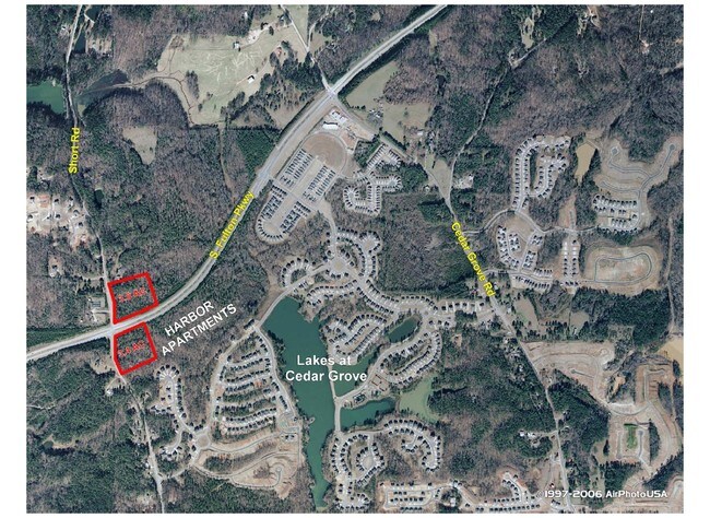
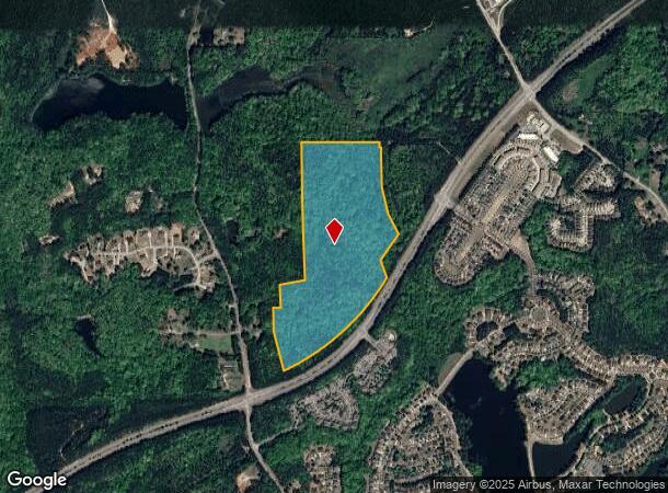
820 S Fulton Pkwy
Atlanta-Sandy Springs-Roswell, GA
Cedar Grove
07-1400-0108-360-8
LAKES @ CEDAR GROVE
Residentialacreage
Fulton
A
Georgia
13121C0434F
57.93 AC
2024
North Clayton/Airport
2025
Atlanta
010524
DEMOGRAPHICS near 820 S Fulton Pkwy
1 Mile
3 Mile
5 Mile
2024 Total Population
3,102
13,450
44,307
2029 Population
3,167
13,957
45,973
Pop Growth 2024-2029
+ 2.10%
+ 3.77%
+ 3.76%
Average Age
38
39
38
2024 Total Households
1,122
4,764
15,635
HH Growth 2024-2029
+ 2.23%
+ 3.88%
+ 3.87%
Median Household Inc
$72,299
$78,391
$77,051
Avg Household Size
2.70
2.80
2.80
2024 Avg HH Vehicles
2.00
2.00
2.00
Median Home Value
$282,075
$260,319
$248,862
Median Year Built
2006
2002
2002
Nearby Places
Map Layers
Map Styles
 Street
 Aerial
- Restaurants
- Banks
- Shops
- Fitness
- Groceries
PUBLIC TRANSPORTATION
AIRPORT
Hartsfield - Jackson Atlanta International
DRIVE
WALK
Distance
Hartsfield - Jackson Atlanta International
26 min
17.3 mi
Freight Ports
Georgia Ports - Savannah
DRIVE
WALK
Distance
Georgia Ports - Savannah
288 min
254.6 mi
Nearby Properties
Address
Land Use
TOTAL SIZE
Lot Size
Zoning
Address
Land Use
TOTAL SIZE
Lot Size
Zoning
938,714 SF
103.25 AC
AG1
Address
Land Use
TOTAL SIZE
Lot Size
Zoning
74.44 AC
Address
Land Use
TOTAL SIZE
Lot Size
Zoning
545,664 SF
27.64 AC
AG1
Address
Land Use
TOTAL SIZE
Lot Size
Zoning
595,060 SF
62.71 AC
Address
Land Use
TOTAL SIZE
Lot Size
Zoning
1,226,360 SF
18.72 AC
AG1
Address
Land Use
TOTAL SIZE
Lot Size
Zoning
351,523 SF
116.48 AC
AG1
Address
Land Use
TOTAL SIZE
Lot Size
Zoning
2,042,096 SF
30.07 AC
MIXU
Address
Land Use
TOTAL SIZE
Lot Size
Zoning
14.83 AC
AG1
Address
Land Use
TOTAL SIZE
Lot Size
Zoning
156,882 SF
25 AC
AG1
Address
Land Use
TOTAL SIZE
Lot Size
Zoning
572,000 SF
46.35 AC
AG1
Address
Land Use
TOTAL SIZE
Lot Size
Zoning
1,320,344 SF
0.35 AC
MIX
Address
Land Use
TOTAL SIZE
Lot Size
Zoning
1,566 SF
41.68 AC
AG1
Address
Land Use
TOTAL SIZE
Lot Size
Zoning
327,822 SF
0.16 AC
MIX
Address
Land Use
TOTAL SIZE
Lot Size
Zoning
169,212 SF
0.20 AC
MIX
Address
Land Use
TOTAL SIZE
Lot Size
Zoning
83,102 SF
10.75 AC
MIX
Address
Land Use
TOTAL SIZE
Lot Size
Zoning
29,612 SF
6.67 AC
MIX
Address
Land Use
TOTAL SIZE
Lot Size
Zoning
26.76 AC
AG1
Address
Land Use
TOTAL SIZE
Lot Size
Zoning
71.49 AC
RL
Address
Land Use
TOTAL SIZE
Lot Size
Zoning
138.20 AC
TCMU
Address
Land Use
TOTAL SIZE
Lot Size
Zoning
69.70 AC
CUP
Address
Land Use
TOTAL SIZE
Lot Size
Zoning
Address
Land Use
TOTAL SIZE
Lot Size
Zoning
81.54 AC
AG1
Address
Land Use
TOTAL SIZE
Lot Size
Zoning
95.25 AC
AG1
Address
Land Use
TOTAL SIZE
Lot Size
Zoning
81.39 AC
CUP
Address
Land Use
TOTAL SIZE
Lot Size
Zoning
2,615 SF
0.78 AC
Address
Land Use
TOTAL SIZE
Lot Size
Zoning
415.86 AC
AG1
Address
Land Use
TOTAL SIZE
Lot Size
Zoning
63.39 AC
AG1
Address
Land Use
TOTAL SIZE
Lot Size
Zoning
87.71 AC
AG1
Address
Land Use
TOTAL SIZE
Lot Size
Zoning
206.70 AC
AG1
Address
Land Use
TOTAL SIZE
Lot Size
Zoning
4,104 SF
111.96 AC
CUP
The World's #1 Commercial Real Estate Marketplace
Connect with us
© 2025 CoStar Group
The information above has been obtained from sources believed reliable. While we do not doubt its accuracy we have not verified it and make no guarantee, warranty or representation about it. It is your responsibility to independently confirm its accuracy and completeness. Any projections, opinions, assumptions, or estimates used are for example only and do not represent the current or future performance of the property. The value of this transaction to you depends on tax and other factors which should be evaluated by your tax, financial, and legal advisors. You and your advisors should conduct a careful, independent investigation of the property to determine to your satisfaction the suitability of the property for your needs.